Friday, December 28, 2012

Cahokia Mounds, IL - Not-quite-the-world-traveler review


Not-quite-the-world-traveler: Cahokia Mounds, IL 


The rush of noise from busy metropolitan St. Louis, the shine of sunlight on the famous arch, the hustle and bustle of 21st century life fade away in the silence of the muggy air on a grassy hilltop in Illinois. Hundreds of thousands of people live just a stone's throw away in St. Louis, many unaware how great an impact a few quiet grassy mounds set with 
the modern convenience of stairs and handrails truly had on the people of this area, albeit before any of their lifetimes.

Today on the top of the largest of the mounds mounds, it is quiet and still, the nearby Mississippi river glinting as it wends its way to the gulf, the only sound the gentle breeze over the grassy hilltop rustling the blades against one another and a lazy insect settling onto the grass heads. A 
few scattered people wander about, some stopping to read the plaques, but most seemingly unaware and somehow not fully impacted by the ancient majesty that was Cahokia. To understand that standing in this place is to stand in the nexus of the ancient cradle of civilization, the largest city of its time on the North American continent or in Europe, the locus of intersecting continent-spanning trade routes seems to pass most of these people by as quickly as cars on the nearby highway. But I am awestruck.
View of St. Louis from Monk's Mound

Let's go back, to a time when Europe's biggest cities housed only tens of thousands, instead of tens of millions. Back to a time before modern conveniences, before global travel, before the technological age descended upon this mound of grass and to the history that is Cahokia.

It's AD 1250 and Cahokia is one of the greatest ancient cities of the world. At this time, it was larger, in fact, than London. An estimated 15,000 to 20,000 citizens in the city proper and up to 30,000 to 40,000 surrounding inhabitants congregated here in a settlement ranging from everyday dwellings to ceremonial structures, occupying a variety of different sized mounds and even giant red cedar woodhenges serving as solar calendars.

 A reconstruction demonstrates Cahokia's astronomical sophistication, which was comparable to that of other ancient civilizations. Cahokia remains the largest archaeological site north of Mexico and contains artifacts from well outside the geographic area, indicating an extensive trade network including elaborate pottery, precious metals such as copper from the Great Lakes region, chert for making tools and implements and minerals like galena. (Per Wikipedia, one of the oldest uses of galena was as kohl, which, in Ancient Egypt, was applied around the eyes to reduce the glare of the desert sun and to repel flies, which were a potential source of disease).

 Also found in the excavation of Cahokia were exotic shark's teeth and fighting whelk shells brought in from locations far removed from present-day Illinois. How did these artifacts arrive here? What is the story that they tell, and most importantly... where did all the people go?
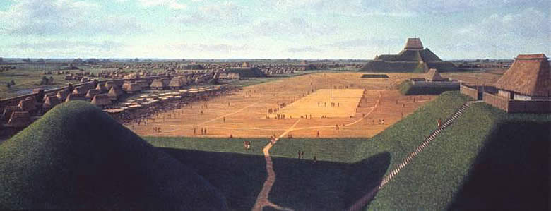
Artist's reconstruction of Cahokia, the largest and most powerful of all Mississippian centers, at about A.D. 1150. The paramount chief, perhaps called the Great Sun, lived atop Monk's Mound, the large mound shown in the background. Painting by L. K. Townsend, courtesy Cahokia Mounds State Historic Site.
Engraved Whelk Shell Depicting Birdman Copper repoussé plaques, A.D. 1200-1400 - Unearthed by a farmer plowing a field, a plaque depicting a birdman figure is made of copper from the Great Lakes region, evidence that Cahokia and other communities were part of a far-reaching trade network.

Cahokia Mounds excavations have revealed a diverse and interesting mosaic of occupation. A great civilization of advanced peoples thrived at Cahokia long before European settlers came to North America. 

A basic timeline begins our story a thousand years ago where a small society flourished in the fertile floodplain of the Mississippi River.

Beginning in 700 AD, Late Woodland people left projectile points to mark their time spent in the area, but had no established long-lasting presence in what would eventually become Cahokia. 

By 800 AD with the cultivation of maize, Mississippian culture advanced along with the emerging agriculturally-based lifestyle. This crop planting and harvest cycle led people to settle in larger, more stationary communities to tend their crops. 

Around 900 AD, pithouses had sprung up for the labor to produce the crop that had become a staple of this culture's diet. Corn had become essential, and required workers to tend it.

Suddenly, in 1050 AD, a dramatic population increase coincides with advancing forms of leadership and a complicated hierarchical structure, all of which were drawing outlying communities to a central location. Over 17 different styles of projectile points were found dating from this time period, ranging in both style and structure, and new housing styles appear as well, possibly indicating the integration of other tribal groups. 

From 1100-1200 AD, in what is referred to as the "Golden Age" of Cahokia, the largest numbers of peoples, rivaling and even surpassing the largest of European cities at the time, had established roots in Cahokia. Creating five giant woodhenges to mark the passage of the seasons, the celestial events of solstices and equinoxes and serving, in essence, as giant calendars, Cahokia truly becomes a cultural phenomenon.

The largest of the mounds is constructed around 1150 AD, and would have been swarmed with thousands of workers during construction, which required an estimated 22 million cubic feet of earth, 15 million baskets of soil. "Monk's Mound" (so named for acommunity of monks that resided near there for a short time after Euroamericans settled) covers 14 acres, rises 100 ft from its base, and was the foundation to a massive 5,000 sq ft building that rose an additional 50 ft high. To give perspective, this mound has a footprint more than twice that of the Roman Colosseum, and it is larger at its base than the Great Pyramid of Khufu, Egypt's largest.
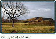
View of Monk's Mound

To our jaded modern eye, that may pale in comparison with St. Louis' glittering skyscrapers sheathed in glass, but the world's first steel frame skyscraper was the Home Insurance Building (originally 10 stories with a height of 138 ft) in Chicago, Illinois in 1885, long after the construction of Cahokia's great mound reached skyward. Monk's Mound is the only multi-terraced mound in eastern North America, and is the largest man-made earthen mound on the entire North American continent.

Adjacent to the great mound was a great plaza covering nearly 50 acres (the size of 45 football fields) where the games were played and public rituals carried out. The most common of the games was "Chunkey", wherein a pill-shaped stone was rolled across the field and men would throw their spears where they predicted the stone would land, requiring great judgement and even better aim. Particularly as the rumored price for defeat was the forfeit of one's life and head.
Illustration of a chunkey player based on a Mississippian gorget design. Artist Herb RoeChunkey player flint clay figurine effigy pipe from Cahokia

From atop this mound, the residing officials would have seen the grandeur of this city at the height of its population. The sight would have been monumental, the mound being the highest structure in the entire floodplain, and located near the confluence of the Mississippi, Missouri and Illinois rivers and maintaining trade links from the Great Lakes to the north and the Gulf coast to the south. At its apex, Cahokia covered approximately 6 square miles and included around 120 man-man earthen mounds in a variety of shapes, sizes and functions and its ancient population would not be surpassed by any city in the United States until around 1800. Never again would Cahokia see this level of population and expansion. Never again would it be at the peak of civilization, industry, trade and the religious, cultural and ceremonial center of this society. Cahokia was a ghost town before Columbus even landed.
The Mississippian peoples experienced a marked decline, and had entirely departed by the 1300s, and in the 1400s only a few sparse Oneota villages to the north had been settled. In the 1600s, Illiniwek confederacy and the sub-tribe of Cahokia moved into the area and actually occupied Monk's Mound for a short time around 20 years. When the French came through in the 1700s the Cahokia peoples were inhabiting nearby and it is for them that the mounds are named, or rather mis-named, as they did not build them, but merely came upon them later.

Today, aside from the artifacts left buried, only the mystery remains - where did they all go? 


The fate of these ancient people is unknown. Even to what they called themselves and the borrowed name assigned to their city by people who never actually lived there. Was it catastrophic disease, crop failure due to the proven climate climate change, threat of warfare and subsequent assimilation into other tribes, declining socio-economic power and simple abandonment of the site, pollution, waste buildup, deforestation, erosion, and over-hunting contributing to the depletion of resources? These and many more causes have all been theorized, but no one knows a definitive answer. Alone, the mystery and the mounds remain, swirling in my mind as I stand, alone, atop Monk's Mound.

------------------------------- More info from the Web:-----------------------------------------


According to the Cahokia Mounds website: Common characteristics exhibited by the Mississippian culture included:
  • Large communal plazas.
  • Monumental 'public' architecture.
  • Flat-topped Temple Mounds, sometimes paired with round top burial mounds.
  • A particular set of religious symbols, found on pottery, copper, shell and stone.
  • Complex hierarchical society.
  • The occasional practice of human sacrifice.
  • Specific styles and decorations on (usually shell-tempered) pottery.
  • The practice of playing the game called "chunkey" with a stone disc rolled down a prepared court.
  • Palisaded villages.
  • Houses with wall post set in narrow trenches.
Excavations during the 1960s-70s had identified historic period (mid 1700s) occupation, burials and a French chapel location on the west side of the First Terrace, all relating to an occupation by Illini (Illinois) Indians long after the Mississippians had left. The testing for the new stairway in the late 1990s also identified some large refuse pits near the center of this terrace, full of the remains of deer, bear, turtles, swans, fish, and other animals, as well as French period ceramics, gun parts, glass and knives.

During excavation of Mound 72, a ridge-top burial mound south of Monks Mound, archaeologists found the remains of a man in his 40s who was probably an important Cahokian ruler. The man was buried on a bed of more than 20,000 marine-shell disc beads arranged in the shape of a falcon, with the bird's head appearing beneath and beside the man's head, and its wings and tail beneath his arms and legs. The falcon warrior or "birdman" is a common motif in Mississippian culture. This burial clearly had powerfuliconographic significance. In addition, a cache of sophisticated, finely worked arrowheads in a variety of different styles and materials was found near the grave of this important man. Separated into four types, each from a different geographical region, the arrowheads demonstrated Cahokia's extensive trade links in North America.
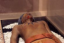
Reconstruction of the Birdman burial in the site's interpretative center
  • Four young males, missing their hands and skulls.
  • A mass grave of more than 50 women around 21 years old, with the bodies arranged in two layers separated by matting.
  • A mass burial containing 40 men and women who appear to have been violently killed. The suggestion has been made that some of these were buried alive: "From the vertical position of some of the fingers, which appear to have been digging in the sand, it is apparent that not all of the victims were dead when they were interred – that some had been trying to pull themselves out of the mass of bodies."

The Birdman Tablet, the official logo of Cahokia Mounds, was found during excavations on the east side of Monks Mound in 1971. The image on the 'front' of the tablet is of a human, dressed in eagle (or falcon) regalia. The 'reverse' of the tablet is plain or cross-hatched, suggesting the pattern on the skin of a snake.

The Birdman Tablet, the official logo of Cahokia Mounds, was found during excavations on the east side of Monks Mound in 1971. The image on the 'front' of the tablet is of a human, dressed in eagle (or falcon) regalia. The 'reverse' of the tablet is plain or cross-hatched, suggesting the pattern on the skin of a snake.

In 1982, the United Nations Educational, Scientific, and Cultural Organization (UNESCO), designated Cahokia Mounds a World Heritage Site for its importance to our understanding of the prehistory of North America. Cahokia Mounds State Historic Site is one of only 21 World Heritage Sites in the United States, and has also been recognized as a U. S. National Historic Landmark. It covers 2,200 acres and is located directly across the Mississippi River from modern St. Louis, Missouri and houses an Interpretive Center whichfocuses on its uniqueness as an urban center. 
Group of Cahokian Artifacts

Archeologists recovered more than 250 other skeletons from Mound 72. Scholars believe almost 62 percent of these were sacrificial victims, based on signs of ritual execution, method of burial, and other factors. 

The skeletons include:
The relationship of these burials to the central burial is unclear. It is unlikely that they were all deposited at the same time. Wood in several parts of the mound has been radiocarbon-dated to between 950 and 1000 CE.
Excavations have indicated that Mound 72 was not constructed as a single mound, but rather as a series of smaller mounds. These mounds were reshaped and covered over to give Mound 72 its final ridge-top shape.
Group of Cahokian Artifacts
Excavations begun in 1966 eventually confirmed that an enormous, two-mile-long stockade surrounded the central portion of Cahokia. The wall appears to have been started around A.D. 1100 and then rebuilt three times over a period of 200 years. Each construction required 15,000-20,000 oak and hickory logs, one foot in diameter and twenty feet tall. The logs were sunk into a trench four to five feet deep and were likely supported with horizontal poles or interwoven with saplings. The stockade walls may have been covered with clay, as well, to protect them from fire and moisture.
Because there is no evidence of invasion at Cahokia some people question the purpose of the Stockade. To a degree, it probably served as a social barrier; however, three things lead most archaeologists to believe that it was primarily a defensive structure: the great height of the wall; the presence of evenly spaced bastions, projections from which archers could shoot arrows; and evidence that portions of the wall were hurriedly built, cutting through residential areas, as if danger was imminent.


All photos and web text courtesy Cahokia Mounds official site at www.cahokiamounds.org 
National Geographic http://ngm.nationalgeographic.com/2011/01/cahokia/burmeister-photography and http://ngm.nationalgeographic.com/2011/01/cahokia/hodges-text 
http://www.texasbeyondhistory.net/tejas/fundamentals/miss.html 
and from Wikipedia.

Thursday, December 27, 2012

Healthier than WHAT?!

Hello my wayward companions!

After far too long an absence from the Blog-O-Sphere due to holiday obligations, travel, picking up a second job, and general miscellany, I am back in the blogging chair! And with a gem retrieved over half my life ago that was so profound in its hilarity that for years afterward neither my mother nor I could rarely even attempt to convey the tale due to the spasms of laughter which would overcome us at every opportunity, much to the amusement of any listener. (Who may still never fully understand the true hilarity of the situation). Nevertheless, I will try my best to convey it to you with the best of my ability.

Tonight's featured episode stars yours truly, my wonderful and ever-hilarious mother, and a cameo by a strangely terrified man, who is most likely irreparably scarred for life. All during what appeared, at first, to be nothing more than an ordinary shopping trip in a grocery store. But first, some back history.

My family has always been a bit... boisterous in public. We are somewhat acclimated to looks of annoyance, perturbation and sometimes borderline rage from fellow patrons in whichever establishment happens to fall victim...er... play HOST to our familial gatherings.

We can't help it. We feed off each other. The jokes become even more hilarious when accompanied by the crimson-hued countenances of my siblings. We expand the joke past common sense, common decency and occasionally, socially-acceptable boundaries. In public. So yes, we are used to getting looks of frustration from random strangers, but rarely terror.

That was all about to change.

To the best of my recollections, my mother and I entered the grocery store, both tired from our week, and me needing luncheable foods for routine high school sustenance.

Well, as previously mentioned, I talk. A lot. But when I'm tired and spaced out, when I have a lot on my mind, if there's something shiny, or if you ask me a question to which the answer isn't immediately upon my tongue, I tend to trail off and not answer a question. (To be clear, however, I do not, typically mumble).

We passed a display near the entrance to the store when we first set upon our circuitous route of the store... and apparently I read the display sign aloud rather than to myself, but apparently just loud enough that my mother caught part of the phrase.

We were well into the produce and I was thinking how precarious it must be for the produce stockers to stack shiny Red Delicious apples into such neat and wax-coated pyramids, when *apparently* out of nowhere my mom looks at me and asks "Healthier than what?"

I blinked at her.

"Healthier than what?" I echoed back, mind clean as a freshly Windexed whiteboard. (No one knows what a chalkboard is anymore...)

She blinked back, puzzled, and slowly pushed the cart past the heaps of produce to the canned goods. "What?" she asks back?

I had no clue.

Enter stage left, a man fastidiously sorting through cans of baked beans, or possibly black beans. Could've been navy beans. Definitely not white beans. I would've remembered.

I looked at my mother, entirely befuddled. "What are you talking about?" I queried.

"Healthier than what." she supplies, as though that were the answer, which it most definitively was not.

The man gave us a cautious glance as we advanced, hurriedly placed his canned goods into his metal cart and skittered away.

We proceeded through the aisles, carrying on our conversation.

"No, mom.... I'm ASKING you. Healthier than what?"

"What?"

"You said, healthier than what!"

"No, YOU said healthier than what. What is?"

She places items into the cart, brows knitting. "What?" She asks me, exasperated.

"What is healthier than WHAT!?" I shoot back, annoyed.

"That's what I'm asking you!" she turns face-on. "What is?!"

"Mom! THAT is what I'm asking you! WHAT is healthier than WHAT? That's what I'm asking!"

In the bread aisle, we again encounter said jittery man, eyeing us with growing concern, shooting us nervous glances as our voices begin to escalate in true Abbott & Costello fashion re-enacting our version "Who's on first" skit, though more heatedly (though less physical violence) due to my mounting frustration with my mother answering my question with a question.

"WHAT is HEALTHIER than WHAT?"

"Yes, that's exactly right!"

"WHAT! That doesn't make any sense!"

"What doesn't?"

"You said 'Healthier than what' so I replied 'What?' and you said 'What' so I said "Healthier than what?' and you said 'Yes!' That isn't an answer. So I'm asking you, WHAT it is healthier than?"

Infuriatingly, Mom says "Exactly!"

The man's eyes have grown wide, I believe his hands may have trembled and his face paled. A second time he fled from us, throwing anxiety-filled glances over his shoulder as he rounded the endcap of stuffing boxes.

Distracted by this man's apparent activation of his fight or flight response, and opting for the latter option, I forgot my line of interrogation temporarily.

Silence.

A rattling cart wheel.

My mother sighs.

I ponder a man frightened enough to run away from a mother and her teenage daughter doing some grocery shopping.

We near the registers.

We pass by a display. I gasp noisily and grab my mother's arm. She jumps.

"HEALTHIER THAN WHAT!!!!!!!" I yell, in characteristic over-reaction. She looks at me as though I've truly cracked this time.

Desperate to explain, I holler, "Hi-C is healthier than the leading boxed juice brand! It's on the sign over there!"

My mother and I gaze at each other momentarily in amused comprehension of our entire conversation and then the hysterical laughter bubbles up from inside me replacing the earlier frustration. I have a remarkably loud (and, often noted, contagious laugh). My laughter pours out of me. I gasp for air, muttering between peals of laughter "Healthier than WHAT!" and my mother inevitably joins me, our laughter growing the longer we go on. We near a checkout lane, and almost beyond comprehension, there stands the man.

In our line.

With eyes big as dinner plates.

Our poor terrified man who looks as though he's become a caged rat trapped behind the rotund lady in front of him who is taking her glorious time laboriously writing a check, and behind him in line, the two of us, guffawing and still repeating our mantra to each other through convulsions of giggles "Healthier than what!?" cackling like deranged maniacs. Which he obviously thought we were prior even to our outburst.

He panics, squeezes past the ample woman writing her check with all the care of a monk illuminating the calligraphy on a medieval sheepskin parchment. He fled, abandoning his purchases, cart and all left stranded in the checkout lane, racing for the door as though the unholy hounds of Hell were nipping at his heels.

Screeching with laughter, my mother and I are literally wiping tears away as we push his cart out of the way while the checker inquires, rather reticently, "Did you find everything okay today?"

I am holding my aching ribs, face nearly purple, my mother is barely able to contain herself, wiping eyes and nose with a tissue that she unearths from the depths of her purse as she says "Oh yes, we found out what it was healthier than!" Our laughter rings anew. Other customers are staring at us. The checker's mouth is half-opened, and incomprehension rests in her eyes.

To this day, I smile writing this post. Perhaps nobody can truly understand and it's a situational humor story only, but if my retelling of our hilarity didn't tickle your funny bone, perhaps the Abbott & Costello version will enlighten you to the true enormity of the confusion we were experiencing.

http://www.youtube.com/watch?v=Watf8_Rf58s
(However, my Mom is MUCH better looking. And shorter. And my voice is a little lower... and I pluck my moustache.)
---------------------------
P.S. - even today, I innocently texted my Mom "What?" in reply to a text I didn't understand from her (a sequence of numbers - remarkably cryptic and no discernible code to unravel the encryption. Turns out it was less exciting than my imagination concocted and she was trying to call someone and mistakenly entered and sent the text from her message screen. I blame Dan Brown and reading Lost Symbol too many times.)

However, in true Mom fashion to my query of "What?" she replied "Healthier than what?" and wrote "I couldn't resist that reply." HA! Yep, it's STILL funny, at least to us!

Which was even more striking because today in my shower, where I do all of my deep thinking, which is why, consequently, I need a MUCH larger hot water heater - and why is it called a hot water heater anyway? You don't have to HEAT hot water... you heat cold, or perhaps lukewarm water. A room-temperature water heater....) ANYWAY, in my shower I was just contemplating how best to write a blog post about "Healthier than What!" So there you have it.

Saturday, December 15, 2012

Parowan Gap, UT - May 20, 2012 - Not Quite the World Traveler: Discover Places that I Love

Not Quite the World Traveler: Discover Places that I Love:

Parowan Gap, UT - May 20, 2012
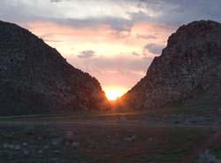
Sunset throught the gap
Sunset at Parowan Gap

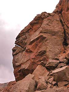
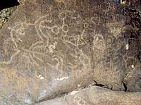
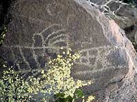
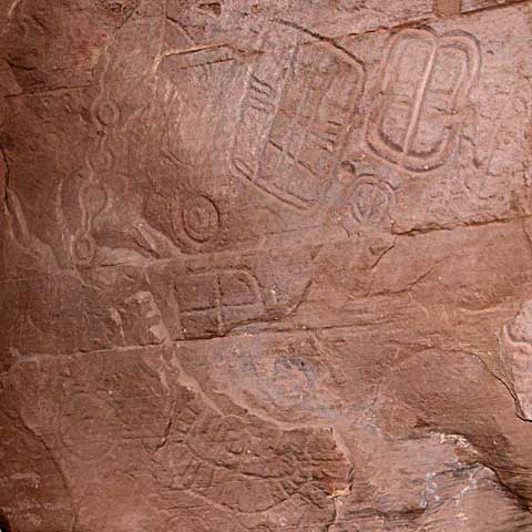
The sun sinks ever so slowly toward the narrow volcanic cleft in the rocks, shooting daggers of light and shadow across the basin, touching upon the rock cairns nestled in the prairie grass and sagebrush. The face of Tobats, The "Overseer" - an easily distinguishable profile of a face, overlooks the gap as thousands of years of human history recede from view while the light diminishes on the petroglyphs carved in the rock walls of the narrow gap. Here the blend of ancient and modern finds an easy rhythm in the calls of the birds from the sage, the cry of eagles nesting in the bluffs and the hum of tires on the asphalt. And we are here on a particularly important day - the first annular solar eclipse visible in this part of the country since 1994, a good 18 years past.

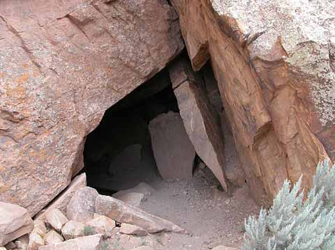
While already an important historically significant site, contemporary to the raising of the monoliths at Stonehenge, and used in a fashion to mark the passage of time and serve as a cosmic calendar for solar alignments of the sun, moon, and other planetary bodies such as the track of the planet Venus across the night sky, our visit on May 20, 2012 was precipitated by the ideal viewing conditions to observe the solar eclipse. While many mysteries surround the significance of many of the thousands of petroglyphs carved into the faces of the rocks here, several have been remarkable in their ability to predict the precise location of the sun and moon throughout the year. Also present within the Gap are two small caves, both inscribed with petroglyphs, and containing remnants of human inhabitants such as flint arrowheads, pottery pieces and evidence of soot from fires left on the ceilings. (And also a few bats!) These artifacts have been carbon dated back to 12,000 years ago. Such an enormity of human existence cataloged and recorded in one place boggles the mind.

As for more recent history, as the Parowan Gap website explains:
When the first Mormon Pioneers came there in 1849, Chief Wakara, a widely revered and greatly respected Paiute tribal leader, told them that Parowan Gap was "God's Own House." Recent research and observation is making both the scientist and casual visitor take this statement very seriously. There are solar and lunar events that happen there which were created by no human intervention. Phenomena occur which create a natural calendric structuring of the year's times and seasons with a kind of "Primal Logic of Nature". The pre-Columbian Fremont Peoples of the Parowan Valley noticed these yearly events and recorded them by date number and in many symbolic petroglyphic inscriptions. (www.parowangap.org)

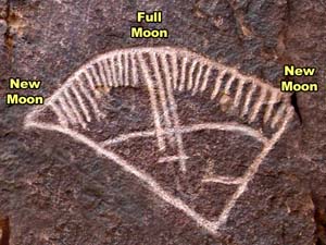
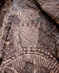
Perhaps one of the most remarkable and memorable of the glyphs is the large aptly-named "Zipper Glyph" with its 180 tic-mark "teeth". Only beginning to be studied scientifically in depth starting in 1990, many of the glyphs were noted to contain lines and dots, tics and and repeating patterns. In studying the Zipper Glyph, it revealed itself to be a map representing the geography of the Gap itself and the surround region, with the tic-marks representing solar alignment positions, and rock cairns spreading into the basin marking the phases of the year for equinoxes, solstices and cross-quarters, or the dates between the equinox and solstices. Deliberately and carefully marked, the large Zipper Glyph is marking the time in observable, categorized segments.

As the website continues to explain "The angle between the arms of the Zipper Glyph closely approximated the horizontal traverse of the sunsets between the solstices. Consequently, we had a glyph of considerable size and detail which contains both the angular traverse of the sun and the number of days it takes to make that traverse. Furthermore the cairn system divides the solar traverse into four equal periods which matches the distribution of counts on the Zipper Glyph." After deciphering the purpose of the Zipper Glyph being used as a solar calendar, it only followed that there would be a corresponding lunar calendar, and there was. It was located just around the bend in the rocks, facing the opposite direction to coordinate with moonrise.
http://www.scienceviews.com/photo/browse/SIA1423.jpg
Similar to the Zipper Glyph, the lunar calendar glyph shows lines which indicate the phases of the moon, and even dividing the lunar cycles into 29 day cycles (months) each containing 4 divisions of "weeks", and even accounting for the partial lunar phase completing the year. Of particular interest to me were the geologic formations through which are visible the sun and moon between the lineup of particular gaps in the rocks, including The Overseer "swallowing" the sun through his mouth to herald the coming of winter and spitting it back out again indicating the turning of the seasons back to spring with re-giving light back to the earth. Another small shaft between the rocks documents the 19 year extreme southernmost rise of the full moon, through which gap the moonrise will appear.
TobatsThe face of The Overseer

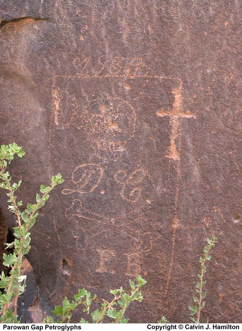
While many legends and stories surround the Parowan Gap, certain irrefutable evidence of past history is inscribed on the walls, such as the Spanish waybill dated 1839 and marked with a skull, crossbones and a cross, and other dates of 1882 and 1887 of settlers and pioneers passing through that left their marks. Unfortunately, modern graffiti including spraypaint and initials inside a heart and names carved into the sandstone spoil some of the petroglyphs located here, and sadly some very important inscribed boulders were destroyed in the forming of the road through the narrow gap in the 1960s, eradicating perhaps as much as half the total petroglyphs on site, a tragedy of epic proportions.
http://www.scienceviews.com/photo/browse/SIA1500.jpg
Spanish Waybill indicating the location of buried booty hidden from the slave revolts and uprisings of the local people captured and forced to work in the mines by the Spanish. These waybills were to disclose the locations of the mines or buried precious metals.

Archaeological evidence has shown that the Parowan Freemont peoples lived in this Parowan valley, near the shores of the shallow salt lake (now dry) located approximately five miles from the Gap. Used as a passageway by ancient peoples, other culture's artifacts have also been located on the site as well. Whether serving as a ceremonial gathering place, a hunting rendezvous, or simply a way to mark their passing, the petroglyphs here weree carved as a ritualistic set of drawings acknowledging the ancestors, their cultural legends and stories, an accounting for the passage of seasons, marking of solstices and equinoxes and a guiding plot map for other celestial bodies. Parowan Gap remains a place imbued with mystery. The footsteps across the ages of ancient peoples who stood in the same place where we now stand, watching the sun slowly making its way down the walls of the gap. Perhaps then even observed another eclipse with all the other-worldly majesty of such a remarkable event.

The moon creeps closer to totality in the eclipse, and the sunlight dims to an odd silvery-gray, the temperature noticeable cools, adding to the goosebumps coursing my skin. The night birds begin their calls, and the moon stands poised to overtake the last edge of sun as the crowd gathers in breathless anticipation. The moon takes over the fiery orb, shooting a flare outwards as a Ring of Fire forms around the sun. The crowd whoops and hollers, cat-calls and howls to the remarkable joining of the moon and sun in the heavens, a pop-top cracks open in celebration, and wondering eyes take in the spectacle for a few precious moments as the alignment of Earth, Moon and Sun form an awe-inspiring moment. Interlaced fingers cast crescent-shaped shadows as the Moon continues its journey, the "horns of the bull" reforming and the light returning to its accustomed golden glow as it sinks ever toward the waiting horizon.  

And finally, to close our adventure through time (and space), here is one of the local legends of "Rush Lake" - the salt lake located close to Parowan Gap. 

The Rush Lake Legend

A Pahute Indian named "Narro-gwe-nap" or Keeper of the Tales related the following legend to William R. Palmer (1877-1960) who was an advisor and advocate to the Cedar City, Utah Pahute Indian tribe.
In the early days, Rush Lake, Utah was a major travel route, watering hole and campground to the Indians. The lake was maintained by a spring that flowed from the point of the black hill. In recent years, Rush Lake has dried up - no doubtedly due to the lowering of ground water by wells in the area.

As the Legend goes, the Indian Oonuput (That one) killed Shinob (The god of love) at Rush Lake. This caused Oonuput great shame and disgrace. The chief god Tobats swore to kill Oonuput.
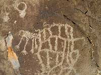
Rush Lake Petroglyph
Petroglyphs at Rush Lake
Tobats built a small fortress on the top of the hill just east of the lake. (According to Palmer, a piece of the wall still stands.) Here Tobats waited for Oonuput to come for water so that he could kill him. Oonuput found out about Tobats plan of vengence and went to nearby water holes. After several days had passed and Oonuput had not come, Tobats decided to dig up all the water holes except for Rush Lake thus forcing Oonuput to come in for water. Tobats carried out his plan and all the water dried up except at Rush Lake.

Several days later as Tobats was inspecting the valley below, he saw Oonuput wriggling through the brush trying to sneak in for water. When Oonuput reached the lake and started drinking, Tobats shot him through the back with an arrow. Oonuput died and turned to stone.

William R. Palmer recalled that when he was a boy, he remembered seeing a large stone in the shape of a man with a hole in its back, lying at the water's edge. The stone was later broken up and placed into the rock fence next to the lake.

After Oonuput was killed, a great darkness fell over the land. It was so dark that fires could not be seen. There was great fear and mourning among the people. During this time, the Indians began wandering off in different directions getting themselves lost in the darkness. Tobats went to the top of the hill and cried down to the people telling them to stay in one place, grasp each other's hands, and to gather into a group. He then told them to come up to the top of the hill and make a circle around him.

In traveling up the hill, the Indians formed a trail that according to Palmer was still there during his lifetime.

After the people were gathered, Tobats took his quiver of arrows and began shooting them into the sky to see if the darkness could be penetrated. The arrows were made with feathers from different types of birds. After several attempts, Tobats picked up an arrow with Flicker feathers on it. The arrow pierced the sky and opened a small hole of light. When the arrow returned the feathers were streaked with red. Tobats then used an arrow with Magpie feathers. The arrow penetrated the darkness and light appeared. Upon returning, the Magpie feathers were streaked with white.
Tobats called the Flicker bird to him. (At that time the Flicker bird had no red.) Tobats told the bird that from this time forth it would be streaked with red in honor of what it did. He then called the Magpie bird to him, which at that time didn't have white, and told the Magpie that it would be streaked with white in honor of what it did. These two birds were sacred to the Indians. (http://www.scienceviews.com/indian/rushlake.html)

  Parowan Gap CaveCave Glyphs
Petroglyphs showing the lines/dots pattern so common here. Entrance to the larger cave and a view of the petroglyphs carved inside.


Information, photos and more courtesy www.parowangap.org, http://www.scienceviews.com/indian/rushlake.html, http://www.scienceviews.com/photo/library/SIA1501.html (please see photo copyright information for Calvin J. Hamilton available at http://www.scienceviews.com/copyright.html)
and various images found on Google search - available on the web 
(Regrettably not noted as this was originally to be for personal use only).

Wednesday, December 12, 2012

Angels Landing, Zion National Park, UT - Not-Quite-the-World-Traveler Review


Angels Landing, Zion National Park, UT - Not-Quite-the-World-Traveler Review
Do you fear heights? Or even more appropriately heights coupled with narrow widths? If so, THIS is not the trail for you!!!
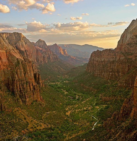
But if you crave just a little heart-pounding (mostly from climbing "Walter's Wiggles" - a series of 21-switchbacks prior to reaching the sandstone spire) and a shot of adrenalin to go with your water and trail mix munchies, then THIS is the hike for you! The view of the Great White Throne, Zion Canyon and the Virgin river winding its way throughout is simply unparalleled, and I guarantee that your salted peanuts will never taste better than from atop this incredible spire!

Angels Landing trail - picture courtesy Wikipedia
According to the National Park Service, "The Angels Landing Trail-West Rim Trail was built in 1926 following the completion of the East Rim Trail. The Angels Landing trail climbs a narrow sandstone spine in a challenging trail carved from the rock, with chain handholds and stone footholds for a 300-foot climb in just .5 miles to end atop the 1,208 foot tall summit.
It joins the West Rim Trail, built in 1925-26 and extended in 1935. Both trails were planned by Thomas Chalmers Vint of the NPS Branch of Plans and Design and Walter Ruesch, the Zion Park building foreman. Reusch lent his name to "Walter's Wiggles", a series of 21 switchbacks leading to Scout Lookout, the last turn-around before heading out onto the rock fin of Angels Landing.The route to Angels Landing involves travel along a steep, narrow ridge with support chains anchored intermittently along the route. Footing can be slippery even when the rock is dry. Unevenly surfaced steps are cut into the rock with major cliff dropoffs adjacent. Keep off when it is wet, icy or thunderstorms are in the area. Plan to be off before dark."
Even while heeding these warnings, and watching your footing, taking pictures only when you've gotten through the tricky spots, the exhilarating hike is well worth it after seeing the glorious panorama of Zion National Park spread before you in its full glory.
The summit of Angels Landing
File:Zion angels landing view.jpg
Zion Canyon and the Virgin River from atop Angels Landing

Friday, December 7, 2012

Kealakekua Bay & Captain Cook Monument in Kailua-Kona Hawaii - Not-Quite-the-World-Traveler Review

 Kealakekua Bay & Captain Cook Monument in Kailua-Kona Hawaii - Not-Quite-the-World-Traveler ReviewView across the bay to the Captain Cook Monument
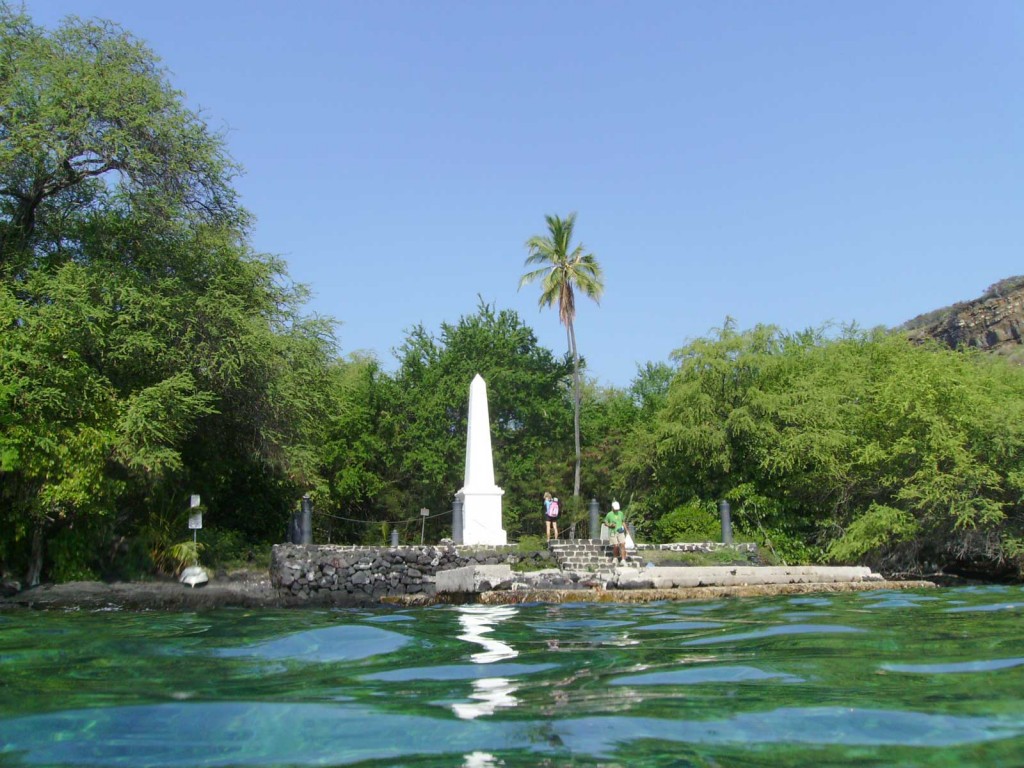
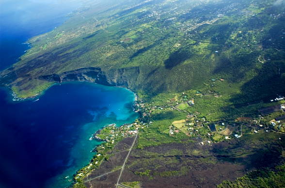
Sparkling turquoise blue water, a veritable rainbow of fish darting in and out of the coral, a ribbon of eel twisting its way through the crystalline water, a sea star groping its long feathery arms across the sand below a school of snorkelers casting shadows on the overlapping bands of light and shadow dancing on the sea floor, and beside it all, a monument to the very real murder of a sea captain and the Hawaiians with a glistening obelisk to commemorate the event. Welcome to Kealakekua Bay and marine life conservation site off Kailua-Kona in Hawaii.
Captain Cook Monument

It is morning on January 17, 1779 and Captain James Cook and his two ships, the Resolution and Discovery, are plying the turquoise waters of Kealakekua Bay (Pathway of the God). They have arrived during a local religious festival wherein the native Hawaiians believe him to be a returning deity and welcomed him to their community. But as circumstances often do tend to unravel when men play at being gods, the fallacy was later revealed when Cook returned to the island shortly thereafter and the Hawaiians surrounded Cook and proved his very real (and imminent) mortality.

As Wikipedia elaborates:

After a month's stay, Cook got under sail again to resume his exploration of the Northern Pacific. However, shortly after leaving Hawaii Island, the foremast of the Resolution broke and the ships returned to Kealakekua Bay for repairs roughly two weeks later. It has been hypothesised that the return to the islands by Cook's expedition was not just unexpected by the Hawaiians, but also unwelcome because the season of Lono had recently ended (presuming that they associated Cook with the deities Lono and Makahiki). In any case, tensions rose and a number of quarrels broke out between the Europeans and Hawaiians. On 14 February at Kealakekua Bay, some Hawaiians took one of Cook's small boats. Normally, as thefts were quite common in Tahiti and the other islands, Cook would have taken hostages until the stolen articles were returned. Indeed, he attempted to take hostage the King of Hawaiʻi, Kalaniʻōpuʻu. The Hawaiians prevented this, and Cook's men had to retreat to the beach. As Cook turned his back to help launch the boats, he was struck on the head by the villagers and then stabbed to death as he fell on his face in the surf. Hawaiian tradition says that he was killed by a chief named Kalanimanokahoowaha. The Hawaiians dragged his body away. Four of the Marines with Cook were also killed and two wounded in the confrontation as well as the deaths of four Hawaiian chiefs and thirteen kanaka maoli (Hawaiian commoners.) The full-scale battle then ensued, only eventually being stopped by British cannon fire forcing everyone to leave the beach.. The esteem in which Cook was nevertheless held by the Hawaiians resulted in his body being retained by their chiefs and elders. Following the practice of the time, Cook's body underwent funerary rituals similar to those reserved for the chiefs and highest elders of the society. The body was disemboweled, baked to facilitate removal of the flesh, and the bones were carefully cleaned for preservation as religious icons in a fashion somewhat reminiscent of the treatment of European saints in the Middle Ages. Some of Cook's remains, disclosing some corroborating evidence to this effect, were eventually returned to the British for a formal burial at sea following an appeal by the crew.


The Death of Captain James Cook, 14 February 1779, an unfinished painting by Johann Zoffany, circa 1795.

Cook Monument on the northern shore of the bay. The chain around the monument is supported by four cannon from the ship HMS Fantome placed with their breaches embedded in the rock in 1876. The inscription reads:
In Memory of
the great circumnavigator
Captain James Cook, R.N.
who discovered these islands on the 18th of
January, 1778, and fell near this spot on
the 14th of February, 1779.

A gleaming white monument was erected near the site of Cook's fatal mauling, the obelisk distinct against its footing of black lava rock and silhouetted against the kiawe trees that in the succeeding generations have overgrown the remains of the two villages overlooking the bay that at the time of Cook's discovered held an estimated several thousand inhabitants. To reach the monument, however, it requires either approach via a rigorous trail or by water. 


The Kealakekua Bay Marine Sanctuary has an area of 314 acres, measures 1.5 miles in length and one mile in width.  It is the largest sheltered natural bay on the island of Hawaii and is considered the best snorkeling for coral reef and wildlife viewing, including spinner dolphins and sea turtles. Magnificent views of the coral reef are to be found as visibility often reaches 100 feet in the clear waters. About 180 acres around the bay was designated a State Historic Park in 1967, and it was added as a Historic District to the National Register of Historic Places in 1973 and the 315 acres  of the bay itself were declared a Marine Life Conservation District in 1969. 

Today, the past violence of the area  washed away long ago by the gentle lapping of azure waves. The bay is a serene and peaceful place, inhabited by the slim colorful bodies of kayaks and the reaching tube-stalks of snorkelers and the sounds of the waves upon the shore. Among the top spots for both snorkeling and scuba diving with incredible visibility down to 200 feet, it is a sight not to be missed for those not afraid of getting their feet - and faces - wet.

Information courtesy of Wikipedia
Photo acknowledgments: 
http://lovingthebigisland.wordpress.com/2009/03/10/big-isand-day-trips-6-i-have-to-see-the-whole-big-island-all-in-one-day/16-captain-cook-monument-and-kealakekua-bay1/ 
http://www.hawaiipictureoftheday.com/captain-cook-monument-kealakekua-bay/ 
http://www.theroamingboomers.com/snorkeling-at-the-captain-cook-monument-in-kealakekua-bay-on-hawaii-the-big-island/

Tuesday, December 4, 2012

The Rock of Gibraltar- Not-Quite-the-World-Traveler Review

The Rock of Gibraltar - Not-Quite-the-World-Traveler Review

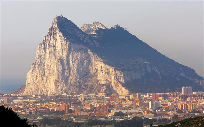
Tucked away at the far end of the United Kingdom's former empire at the edge of Spain and almost reaching across to Africa lies a little peninsula of land dwarfed by a giant limestone rock edifice rising 1,398 feet and overlooking both the Bay of Gibraltar and the Alboran Sea.  
Gibraltar, once the home of one of the 7 Ancient Wonders, where myths hold that The Pillars of Hercules stood sentinel here, guarding over the edges of the known world. Called "Mons Culpa"  by the Romans, the opposing Pillar in Morocco being "Jebel Musa" (Mount Moses in English). However, not only were the Phoenicians, Greeks, the Romans, the Moors, the Vandals and Visgoths, the Africans, the Spanish and the United Kingdom all vying for this chunk of historic real estate, excavations show that Neandertals used the caves as early as 30,000 years ago. 

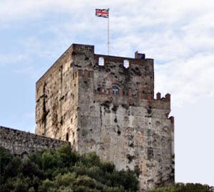
The Gibraltar Castle
www.gibnet.com
Modern travelers can, on a clear day, see across the strait to Morocco in North Africa, and rise from a sea-level entry of the peninsula to O'Hara's Battery at 1,398 feet above sea level, where one side of the Rock is dropping off in near-vertical cliffs. The town of Gibraltar is primarily inhabited by military, dock workers and ever-present tourists. Short on land area, the entry roadway is bisected by Gibraltar's airport runway. Upon crossing the border from Spain, suddenly signs change from imperious Spanish to quaint English, and the Barbary apes (macaques) inspect all tourists thoroughly. All affairs are staunchly presided over by a Moorish castle on the heights overlooking town. The Moorish occupation lasted for 710 years and the castle was originally built in AD 711, though most has worn down to ruins. The principal building that remains is the Tower of Homage, a massive building of brick and very hard concrete called tapia. The upper part of the tower housed the former occupants' living apartments. This tower and a Moorish bath remain and are open to tours.

Composed of limestone, the Rock is riddled with over a hundred caves - the most prominent of these being St. Michael's Cave- used as an infirmary, a picnic ground, concert hall and theater, a dueling ground, as a prison, and during World War II was fully prepared for a role as an emergency military hospital, though it was never used as one. While blasting for additional air exchange holes for the cave, Lower St. Michael's Cave was discovered, and the area opened up now contains even a stage where the annual Miss Gibraltar pageant is held, as well as electrical lighting and theater seating for 100.
http://www.arrakeen.ch/andalusia/114%20%20St.Michael's%20Cave.JPG
St. Michael's even has an air of mystery with an unexplained disappearance by an off-duty officer and his companion. Colonel Mitchell and his counterpart disappeared in 1840 while searching for adventure in their down time, however they left on their expidition and were never seen again, despite extensive explorations of the cave system in 1840, 1857 and 1865. Additional scientific examinations of the cave between 1936 and 1938 combed the known areas of the entire cave system, but the officer's remains were never recovered, nor evidence of their whereabouts ever obtained, leaving an eerie unsolved mystery. 

Additionally of note on Gibraltar, the Barbary Macaques are the only known population in all of Europe, and the roughly 300 animals are under strict care, receiving supplemental food in the form of fruits and vegetables in addition to their forage sources, as well as veterinary care. All of the "Barbary Apes" are individually tattooed and microchipped. Truly a fascinating place.
https://c479107.ssl.cf2.rackcdn.com/files/28866/width668/s46bkhb5-1375890720.jpg

Facts from Wikipedia:

  • The first factual description of the cave was written in 45 AD by Pomponius Mela, an Algeciras born geographer. He described Gibraltar as:"A mountain with wonderful concavities, which has its western side almost opened by a large cave which may be penetrated far into the interior." However, the writings of Homer as well as artifacts discovered in the cave show that it was already well known to the ancient Greeks, Romans and Phoenicians.
  • In 1974 a Neolithic bowl was discovered in the cave, one of many examples which prove that the cave was known to prehistoric man. Another would be the recently discovered cave art depicting an ibex drawn in charcoal on one of the cave walls. It has been dated to the Solutrean period (15,000 to 20,000 years ago) based on the style used. However, since two Neanderthal skulls have been discovered in Gibraltar, it is possible that they were among the first to set foot in the cave around 40,000 BC.
  • Further excavations have uncovered numerous prehistoric artifacts such as stone axes and arrow heads, shell jewelry, bone needles as well as a large collection of pottery
  • The Cathedral Cave in the Gibraltar cave complex was long believed to be bottomless, making St. Michael's Cave the subject of one of Gibraltar's most famous legends. It was believed that the cave is one end of a subterranean Ley tunnel over 15 miles long which passes undersea across the Strait of Gibraltar. Legend has it that the Barbary Macaques entered The Rock from Morocco by this passage.
  • As the Rock of Gibraltar was thought to be one of the legendary Pillars of Hercules, the Ancient Greeks also believed the cave be the Gates of Hades, an entrance to the underworld
  • Rumor holds that as long as the Barbary Apes survive on Gibraltar, the British will continue to hold Gibraltar. So firmly rooted was this suspicion that during war time in 1942 when the population dwindled to a mere 7 individuals, the replenishment from Morocco of additional monkeys was ordered by Sir Winston Churchill
  • The Barbary Apes are a misnomer as macaques are actually monkeys, not truly apes. They are featured on both the 5 pence and penny coins of Gibraltar.
  • The upper portion of the rock is preserved as a Nature Park and habitat for the famous Barbary Apes.
  • Gibraltar was featured in Steig Larsson's best-seller "The Girl with the Dragon Tattoo" trilogy.
  • http://juliecoleman.org/wp-content/uploads/2011/03/rock-of-gibraltar.jpg
  • All pictures credited in captions.